


Businessman Artur Shehu breaks his silence: I am a long-time land owner in Zvërnec, I don't know the investors at all
Albanian businessman Artur Shehu spoke on the Opinion show...
Albanian businessman Artur Shehu spoke on the Opinion show...

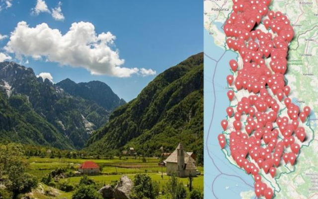
The Albanian government has today approved the declaration of a "priority area for the development of the mountain economy" in the territory of the Municipalities of Shijak, Mat and Shkodra, as part of the approvals of the "Mountain Package".
According to the VKM0, the types of activities that will be developed in this area are economic,
industrial and tourist development.
In the territory of the Shijak Municipality:
a) Development zone no. 1, Maminas administrative unit, Rubjek area, Rubjek reservoir 2, with an area of ??169.56 (one hundred and sixty-nine point fifty-six) ha, according to the map in the KRRGJSH system presented on the orthophoto;
b) Development zone no. 2, Maminas administrative unit, Rubjek area, Rubjek reservoir 1, with an area of ??3.88 (three point eighty-eight) ha, according to the map in the KRRGJSH system presented on the orthophoto;
c) Development zone no. 3, Maminas administrative unit, Rubjek area, Rubjek reservoir 1, with an area of ??4.48 (four point forty-eight) ha, according to the map in the KRRGJSH system presented on the orthophoto;
ç) Development zone no. 4, Maminas administrative unit, Karrec area, Karrec reservoir, with an area of ??32.15 (thirty-two point fifteen) ha, according to the map in the KRRGJSH system presented on the orthophoto;
d) Development zone no. 5, Maminas administrative unit, Karpen area, Karpen reservoir, with an area of ??1.86 (one point eighty-six) ha, according to the map in the KRRGJSH system presented on the orthophoto;
dh) Development zone no. 6, Maminas administrative unit, Karpen area, Karpen reservoir, with an area of ??2.57 (two point fifty-seven) ha, according to the map in the KRRGJSH system presented on the orthophoto;
e) Development zone no. 7, Maminas administrative unit, Karpen area, Karpen reservoir, with an area of ??10.01 (ten point zero one) ha, according to the map in the KRRGJSH system presented on the orthophoto;
ë) Development zone no. 8, Maminas administrative unit, Metalla area, Metalla reservoir, with an area of ??3.5 (three point five) ha, according to the map in the KRRGJSH system presented on the orthophoto;
f) Development zone no. 9, Maminas administrative unit, Metalla area, Metalla reservoir, with an area of ??1.7 (one point seven) ha, according to the map in the KRRGJSH system presented on the orthophoto;
g) Development zone no. 10, Maminas administrative unit, Metalla area, Metalla reservoir, with an area of ??2.7 (two point seven) ha, according to the map in the KRRGJSH system presented on the orthophoto;
gj) Development zone no. 11, Maminas administrative unit, Metalla area, Metalla reservoir, with an area of ??3 (three) ha, according to the map in the KRRGJSH system presented on the orthophoto;
h) Development zone no. 12, Maminas administrative unit, Metalla area, Metalla reservoir, with an area of ??5.1 (five point one) ha, according to the map in the KRRGJSH system presented on the orthophoto;
i) Development zone no. 13, Maminas administrative unit, Metalla area, Metalla reservoir, with an area of ??4.9 (four point nine) ha, according to the map in the KRRGJSH system presented on the orthophoto;
j) Development zone no. 14, Maminas administrative unit, Metalla area, Metalla reservoir, with an area of ??4.5 (four point five) ha, according to the map in the KRRGJSH system, presented on the orthophoto;
k) Development zone no. 15, Maminas administrative unit, Metalla area, Metalla reservoir, with an area of ??1.4 (one point four) ha, according to the map in the KRRGJSH system presented on the orthophoto;
l) Development zone no. 16, Gjepalaj administrative unit, Shetël and Likesh areas, Callika reservoir, with an area of ??8.16 (eight point sixteen) ha, according to the map in the KRRGJSH system presented on the orthophoto;
ll) Development zone no. 17, Gjepalaj administrative unit, Shetël and Likesh areas, Callika reservoir, with an area of ??18.36 (eighteen point thirty-six) ha, according to the map in the KRRGJSH system presented on the orthophoto;
m) Development zone no. 18, Gjepalaj administrative unit, Çizmeli area, Çizmeli reservoir, with an area of ??16.73 (sixteen point seventy-three) ha, according to the map in the KRRGJSH system presented on the orthophoto;
n) Development zone no. 19, Gjepalaj administrative unit, Kënetë area, Shtraza reservoir, with an area of ??5.3 (five point three) ha, according to the map in the KRRGJSH system presented on the orthophoto;
nj) Development zone no. 20, Gjepalaj administrative unit, Gjepalaj area, Terzie reservoir, with an area of ??1.98 (one point ninety-eight) ha, according to the map in the KRRGJSH system presented on the orthophoto.
In the territory of the Municipality of Shkodra:
Area no. 1, administrative unit Shala, village Theth, cadastral area 3597, with an area of ??2286.3 (two thousand two hundred eighty-six point three) ha, according to the map in the KRGJSH system presented on the orthophoto;
b) Area no. 2, administrative unit Shala, village Nderlysaj, cadastral area 2771, with an area of ??425.9 (four hundred twenty-five point nine) ha, according to the map in the KRGJSH system presented on the orthophoto;
c) Area no. 3, administrative unit Guri i Zi, village Rragam, cadastral area 3148, with an area of ??474.5 (four hundred seventy-four point five) ha, according to the map in the KRGJSH system presented on the orthophoto;
ç) Area no. 4, Guri i Zi administrative unit, Sheldi village, cadastral area 3329, with an area of ??388 (three hundred and eighty-eight) ha, according to the map in the KRGJSH system presented on the orthophoto;
d) Area no. 5, Guri i Zi administrative unit, Mazrek - Shpor villages, cadastral area 2624, with an area of ??845.8 (eight hundred and forty-five point eight) ha, according to the map in the KRGJSH system presented on the orthophoto.
In the territory of the Municipality of Mat:
a) Development zone no. 1, the area of ??the Gërman lakes, the village of Selixë, part of the administrative unit of Komsi, with an area of ??2,051,282 (two million fifty-one thousand two hundred and eighty-two) m², according to the map in the KRGJSH system presented on the orthophoto;
b) Development zone no. 2, the former Vila e Zogut area, the village of Selixë, part of the administrative unit of Komsi, with an area of ??1,585,237 (one million five hundred and eighty-five thousand two hundred and thirty-seven) m², according to the map in the KRGJSH system presented on the orthophoto;
c) Development zone no. 3, the area of ??the crown of the village of Selixë, part of the administrative unit of Komsi, with an area of ??2,564,391 (two million five hundred and sixty-four thousand three hundred and ninety-one) m², according to the map in the KRGJSH system presented on the orthophoto. /CNA

This Wednesday, several important changes were made in the...
The head of the Democratic Party of Kosovo, Dashamir Shehi...

MP Erald Kapri stated today that there have recently been ...

Democratic Party MP Luan Baçi spoke about the gender equal...
Prime Minister Edi Rama has shared on social media footage...
The President of the Association of Local Elected Official...

The Deputy Chairman of the Economy Committee, Eno Bozdo, i...
The European Union Ambassador to Tirana, Silvio Gonzato, i...
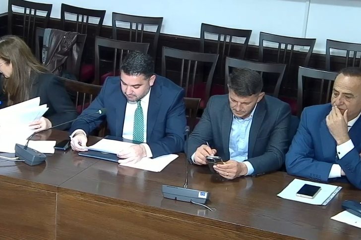
Two parliamentary committees will meet today. The Committe...
Minister of Defense, Pirro Vengu, has announced that inter...

Political scientist Ermal Hasimja commented today on the s...

Democratic Party MP Albana Vokshi, invited to Syri TV, spo...

International Affairs expert Ilda Zhulali, invited to Syri...

On the International Day for the Elimination of Violence a...

Democratic Party Leader Sali Berisha has once again expres...

Democratic MP Saimir Korreshi stated today that there are ...
The Democratic Party Parliamentary Group has today submitt...
Former MP Lefter Maliqi criticized today the condition of ...

The Chairman of the Socialist Party Parliamentary Group, T...

The leader of the Democratic Party of Albania, Sali Berish...

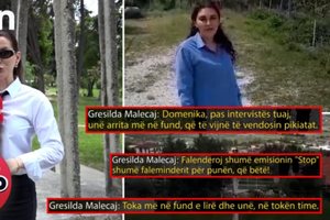
The next case broadcast on the show "Stop", this Thursday,...
The case published this Thursday, June 4, on the show "Sto...

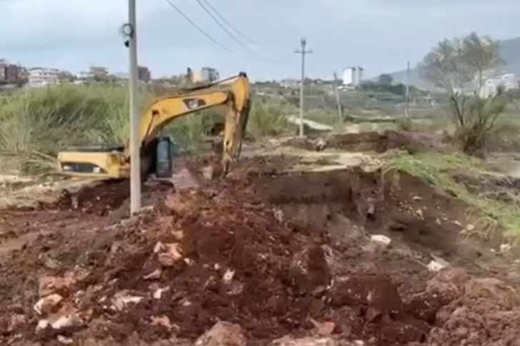
The protests of recent days related to the situation in Zv...
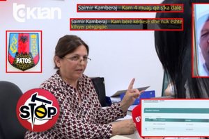
The case addressed this Wednesday, June 3, on the show "St...

The Special Board of Appeal (KPA) decided this Monday ...

The KPA vetting decided this Thursday to dismiss the p...

Suela Salavaçi, a prosecutor in the Prosecutor's Offic...

The Special Board of Appeal reinstated the prosecutor ...
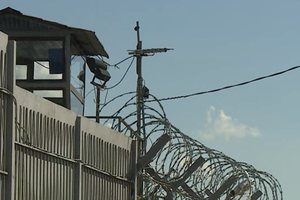
A convict was found dead today in the premises of the Pris...
Several images provided by CNA show the area where this mo...

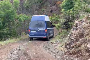
A quantity of explosive material exploded this morning at ...

The Head of the State Police, Skënder Hita, expressed his ...

For many children and teenagers, the long summer holidays ...
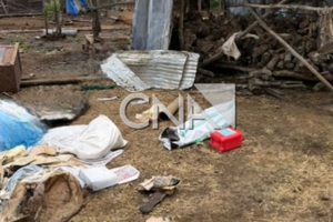
Witnesses in Lozhan, Maliqi, have shared details from the ...

Albania is facing an unprecedented demographic transition,...
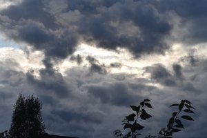
On Thursday, our country will be affected by unstable weat...

Russian President Vladimir Putin said the war in Ukraine c...

An extraordinary story of survival has been recorded in Ne...
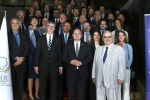
The Peace Implementation Council in Bosnia and Herzegovina...

John Bolton, the former national security adviser to US Pr...
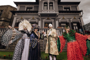
Korça is ready to open the summer season with one of the c...
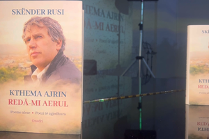
Two years after his passing, the renowned Korçë poet Skënd...
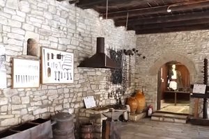
The Ethnographic Museum of Berat has opened its doors to v...
The story of Harilla Bakalli is one of the most chilling t...

The government aims to transform the country's industrial ...

Kursi i këmbimit të euros me lekun ka rënë më tej këtë jav...

Profit margins in the construction sector have increased s...

The Transparency Board, at its meeting today, decided to i...