

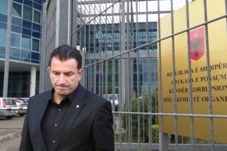
"Albanian groups also operate from Senegal"/ Softa: West Africa a new criminal corridor
Criminalistics expert Fatjon Softa, invited to Syri TV, ha...

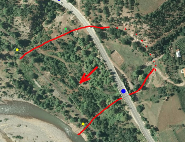
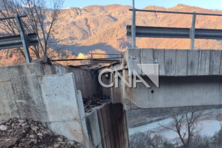
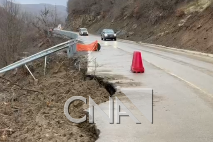
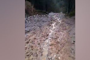
Geotechnical expert Rrahman Kola commented today on the situation in the Dragostunja area, where a landslide occurred on one side of the hill, resulting in numerous traffic difficulties.
Kola initially indicated that about 25 years ago, when the construction company opened the foundations of the concrete retaining walls, a large amount of water and instability of the conglomerate rocks were observed.
"There, in 1999-2000, when the construction company MAVROVA opened the foundations of the concrete retaining walls, there was a large amount of water and the conglomerate rock blocks were unstable due to cracks and a slope of 25-39 degrees (the angle of decline towards the river)," the expert says.
The expert adds that deforestation and erosion created on the lower slope have also had their impact on this land displacement.
"Also on the slope below, deforestation and erosion do their job due to the presence of groundwater, in places we also have unconnected formations which, due to the load, undergo displacement according to the slope of the terrain. The removal of inert materials in the river may have an effect, but we see that there is no erosion on the slope. The railway once had problems there, but the place was filled with large stones. The same situation is without going to the train station in Xhyrë, but even there it was filled with drainage material to filter groundwater. We see many "competents" who have the word corruption, thief, etc. stuck in their minds. The feasibility study was done by ALTEA, while a detailed geological study was missing", explains Kola.
According to Kola, another factor could be the blockage of the natural rainwater channel, especially in a period like the last few years, with intense rainfall.
"Small diameter manholes, in places where rainwater flows. As far as can be seen, rainwater has been flowing there for probably hundreds of years, the area that is sliding is between two ''streams''. That's why the old road has two bridges, the ones with blue dots, and the railway below has 2 bridges, the ones with yellow dots, which on the new road, apparently, one is completely blocked at the bridge that is collapsing (the one with the big blue dot), while on the other they have built a manhole with a diameter of about 1 meter. We once heard the expression ''Never block the natural channels where rainwater flows''. This period has had heavy rains above normal, and when rainwater does not find a free path to pass, it enters the ground, and in that case it serves as a softener and lubricant that causes landslides of soil or rocks, this is something that is known, "- said Kola.
The expert added that it was not in vain that the old rule of design engineers required a broader interest among local residents who knew the specifics, unlike the computer projects used today.
"That's why, before designing roads, engineers, in addition to studying maps, also asked local residents about the specifics of the terrain. Now they rely heavily on computer projects," the expert explains./ CNA

Criminalistics expert Fatjon Softa, invited to Syri TV, ha...

Former Minister of Defense, Fatmir Mediu, has requested th...
The landslide situation in Dragostunje, at the place calle...

Journalist Artan Hoxha said today that the country needs a...
On January 3, 2018, a bank in Albania refused to transfer ...
Today, the Appeals Court of Kosovo will hold a hearing on ...
Engineer Xhevair Ngjeqari commented on the massive landsli...
The Director of the Albanian Road Authority, Ami Kozeli, s...

Analyst Andi Bushati said today that the way the trial in ...

Journalist Bledian Koka said this Monday that the scenario...

Journalist Armand Shkullaku commented today on development...

The period of Great Lent, besides being a period of journe...

Journalist Mentor Kikia said today that handling the issue...

Journalist Klodiana Lala shared today on the show "The Une...

Journalist Klodiana Lala shared new details this evening r...

The Tirana Administrative Court has rejected the request f...
Several changes have occurred in the leadership structure ...

A new instruction published in the official gazette paves ...
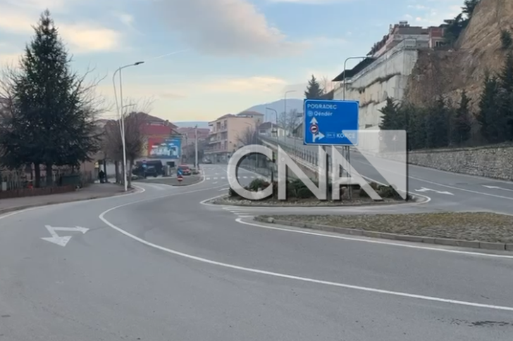
At a time when vehicle traffic has been diverted towards t...
The Constitutional Court decided today to accept the reque...
Dritan Prençi is the SPAK prosecutor who is sleeping on th...
The in-depth investigations that SPAK conducted into Ajola...
SPAK's standards, the way it investigates, how it secures ...

Irfan Hysenbelliu claims to be a big businessman, an hones...

The Special Board of Appeal (KPA) decided this Monday ...

The KPA vetting decided this Thursday to dismiss the p...

Suela Salavaçi, a prosecutor in the Prosecutor's Offic...

The Special Board of Appeal reinstated the prosecutor ...

The two German tourists who lost contact while exploring t...

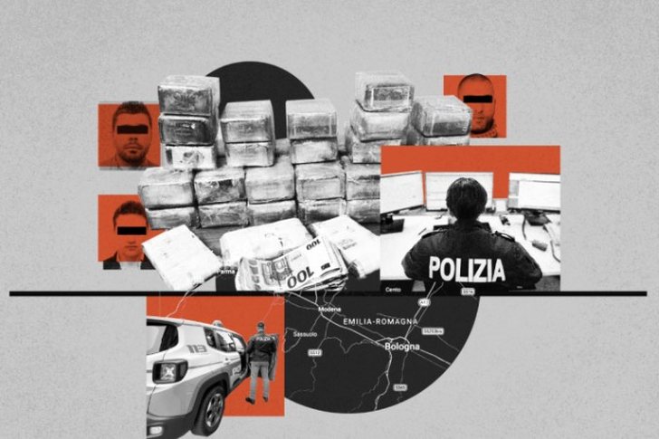
After finding 7446 narcotic plants in the village of Reç i...

Following Operation "The Wanted", a 42-year-old man wanted...

As a result of intensive investigative and operational act...

The UN's World Meteorological Organization now warns that ...
Intense rainfall has caused numerous problems in the Radom...
Today our country will be affected by relatively unstable ...

On Monday, our country will be affected by relatively stab...

Bulgaria's newly appointed Defense Minister, Dimitar Stoya...

NASA has named its crew for its next major mission to the ...

Five people have been arrested in Kosovo on suspicion of i...
Six Georgian citizens appeared before a Paris court on Tue...

Korça has transformed this weekend into the capital of cel...

Korça is ready to open the summer season with one of the c...
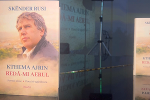
Two years after his passing, the renowned Korçë poet Skënd...
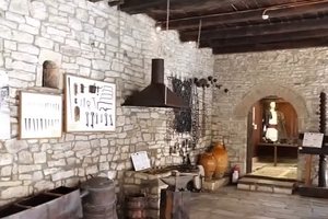
The Ethnographic Museum of Berat has opened its doors to v...

Predictions of a severe oil shortage this summer have not ...
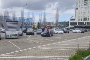
Improving the performance of public parking lots in Vlora,...

Inflation has increased in May, rising to 3% compared to 2...

Exchange rate, June 8, 2026 This Tuesday, one US dollar is...